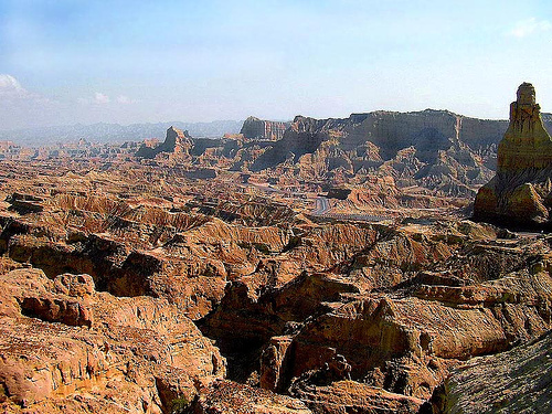
Plains and Plateaus
The land surface of Pakistan is an amalgamation of varying physical properties of the earth
surface, i.e., from seashore to deserts, plains and plateaus to finally towering pinnacles rising to 28,000 feet and more. The plains of Pakistan include coastal area, upper and lower Indus plain, the Balochistan Plateau, Salt Range and Potwar Plateau.
Pakistan, a mostly a dry country characterized by extremes of altitude and
temperature, has three main river basins: Indus, Kharan and Mekran. The
Indus Plain extends principally along the eastern side of the river, and the
Balochistan Plateau lies to the south-west. Four other topographic areas are
the narrow coastal plain bordering the Arabian Sea; the Thar Desert on the
border with India; the mountains of the north and north-west; and the Kharan
Basin, to the west of the Balochistan Plateau.
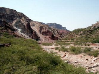
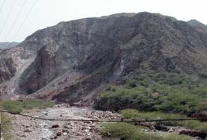
Balochistan Plateau:
The area west of the Suleman and Kirthar mountains constitutes the Balochistan Plateau, located on an average height of 600-900 metres. To the west, mountains of Toba Karrar and Chagai separate Balochistan from the neighbouring Afghanistan. Due to absence of any meaningful rains, the north western part of the plateau is generally sandy and lifeless. However, sterams of water gush into the area if it rains. Devoid of any major river, Zhob River which has its headway in the Suleman mountains, falls into Gomal River. Hamman Mashkhel Lake is a salt water lake in the area. Coal, natural gas,
chromites, iron and copper are some of the minerals that abound the Balochistan Plateau.
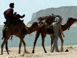
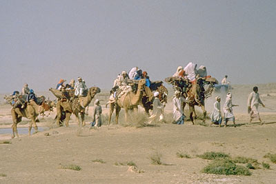
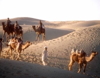
The Makran coastal dunes - Locals on Camels
Coastal Area:
The coastal area of Pakistan stretches along the Arabian Sea for some 1000 km from the marshy Rann of Kutch to Iran in the west. The Makran
(Urdu: مکران) Coast Range forms a narrow strip of mountains along about 75 percent of the total coast length, or about 800 km.
The name of the area might have been derived from Persian "mah-i-khoran"
(fish eaters), Sumerian "magan", or Parthic "makuran".
The steep mountains along the coastline rise to an elevation of up to 1,500 m .
The coast of Makran possesses only one island, Astola Island, near
Pasni, and several insignificant islets. The coastline can be
divided into an eastern lagoon coastline and a western embayed
coastline. The main lagoons are Miani Hor and Kalamat Hor. The main
bays of the embayed coast are Gwadar West Bay and Gwatar Bay. This
latter bay shelters a large mangrove forest and the nesting grounds
of endangered turtle species.
Two ancient Harappan era settlements
have been found at Sutkagen dor (on Dasht River)and Sokhta Koh (astride Shadi
River). The coastal sites are evidence of trade between Harappan and Sumerian
cities as well as those of the Gulf region.
Makran was conquered by Cyrus in 530 BC.
One of the earliest historical
references to the area is the crossing by the army of Alexander the Great during
its return from South Asia, as recorded in the journals of Nearchos. According
to Nearchos,
Alexander had wanted to surpass the
achievements of Queen Semiramis and Cyrus the Great, whose attempts to cross the
desert with armies had ended in disaster. However it has also been suggested it
was necessary to take this route to travel in support of the Greek fleet.
According to Plutarch, only one quarter of the Alexander's army survived the
journey.
The Arabs settled in Makran in
643, and Muhamad ben Qasim Al Thakafi introduced Islam there in 711. According
to the Moslim geographers of that time, Makran was a desert and hostile land. In
Xth century, the Afghan Ghaznevid dynasty established in Makran a vassal Emirate
to gain an access to the sea. The Ghorid dynasty did the same in 1186. In 1290,
Marco Polo sailed along the coast of Makran and mentioned "Kesmacoran", ruled by
a Baluch king. In 17th century, a local ruler, the Khan of Kalat, offered the
area to the Sultan of Musqat, who appointed a "wali", a kind of
Governor-Resident. In 1958, the Sultan of Oman sold the territory to Pakistan,
which incorporated it into the province of Balochistan.
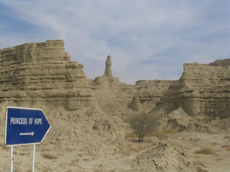
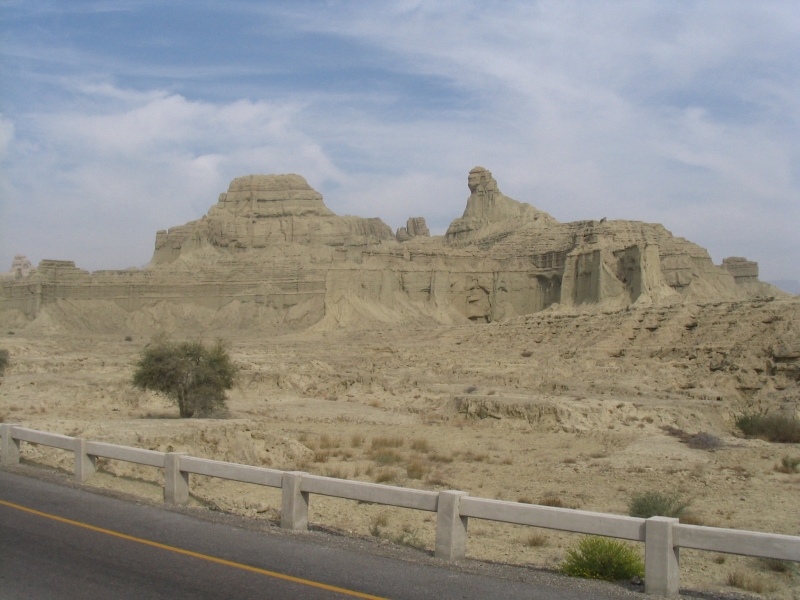
Wonders of nature along Makran
Coastal Highway - Princess of Hope (left) - Sphinx (right)
(The name Princess of Hope was
given by Hollywood actress Angelina Jolie on her visit to this area)
Of late the coastal area is
extensively been developed, mainly in view of its economic, strategic and
military significance in the region, Gawader Port on the mouth of Persian Gulf, and the Ormarah Naval Base are two mega projects to mention. Besides a coastal highway is also under
construction from Karachi to Gwader, which when coupled with the Gwader Port will have a great impact on the development of the coastal area.
The development of the
Makran Coastal Highway
is yet another feat of engineering marvel - the 675 kilometres long road along
the coast line has been built by the Pakistan Army engineers linking Karachi
with the farthest end - the Gwader port.
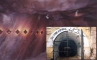
Khwera Salt Mines Entrance
The Salt Range and Potwar Plateau:
The area between Tilla Jogian - Bakrala Hills near River Jhelum to Suleiman mountains is the area of Slat Range. The range sits at an altitude of no more than 600 - 700 metres, except on point near Khusahb, where its rises to about 1500 meters at Skesar and one is fascinated to find snow amidst
some of the driest and hottest plains and low hills in Pakistan. The
Khwera Salt Mines
are the biggest salt mines in the world, discovered in 1922 and till continue to produce the best quality of salt. One must never miss to visit these mines, which are hardly half an hour drive from the motorway (Balkasar interchange).
The Salt Range is dotted with Hindu temples, of which the most notable is the
Katas Raj, located 25 kilometers from Chakwal.
Kohistan-e-Namak (Salt Mountains)
Salt Range
North of the Salt Range is a tableland or the Potwar Plateau, locally
called Pothohar (Urdu: سطح مرتفع پوٹھوہار) which rises to almost the same height as that of the Salt Range.
Bounded on the east by the Jhelum River, on the west by the Indus, on the north
by the Kala Chitta Range and the Margalla Hills, and on the south by the Salt
Range. It includes districts of Rawalpindi, Attock, and Jhelum. Two small rivers, i.e., Swan and Haru,
irrigate the valleys and fall into the Indus River. Potohar Plateau is really
undulating, multi-colored, picturesque and geographically ill-defined area.
Pothohar is the country of the war-like Gakkhar clan, later confirmed by the
first Mughal Emperor Babur; "Sultan Sarang was now of age, and finding that he
could not oust his cousin (Hati Khan) by force of arms, he procured his death by
posion and assumed the chief-ship in 1525. He and his brother made their
submission to Babur, and Adam Khan, with a Gakkhar force, attended him to Delhi,
and for this the Pothohar country was confirmed to them by the Emperor. "
The diverse wildlife like urial, chinkara, chakor, hare, porcupine,
mongoose, wild boar, and Yellow-throated Martin add color to the beauty of the
area. Due to low rain fall, extensive deforestation, coal mining and oil and gas
exploration, the Valley is becoming devoid of vegetation. The under water areas
of lakes (Uchali,
Khabeki
and Jhallar - internationally recognized Ramsar site, and scenic
Kallar Kahar)
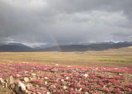
have reduced to much smaller areas than in the past. Experts say that the lake
has been here for at least 400 years. Locals tell about a strange phenomenon
that was observed over Ucchali Lake in 1982. A very broad and distinct rainbow
appeared over the horizon of Ucchali and was seen continuously for 15 days. No
scientific explanation of this has been given so far, but the locals think that
the rainbow appeared because of a volcano hidden under the lakes. They also tell
that because of the hidden volcano the water of the Lake keeps changing color.
Its varied landscape is constantly affected by erosion. The area was the home of
the Soan Culture, which is evidenced by the discovery of fossils, tools, coins,
and remains of ancient archaeological sites. Some of the earliest Stone Age
artifacts in the world have been found on the plateau, dating from 500,000 to
100,000 years. The crude stone recovered from the terraces of the Soan carry the
account of human grind and endeavors in this part of the world from the
inter-glacial period. Rohtas
Fort
located in the Potwar is another UNESCO World Heritage site, built by Sher
Shah Suri in 1541 to control the Gakkhars who remained loyal to the deposed
Mughal Emperor Humayun. Pharwala Fort is about 40 km from Rawalpindi beyond
Lehtrar road. The Gakkhar ruler, Sultan Kai Gohar built it in 15th century on
the ruins of a 10th century Hindu Shahi Fort. Emperor Babur attacked the fort in
1519 AD before Hati Khan had acknowledged him.
The modern day cities of
Islamabad and Rawalpindi sit on the plateau. The material remains found on the
site of the city of Rawalpindi prove the existence of a Gandhara Buddhist
establishment contemporary to Taxila but less celebrated than its neighbor. It
appears that the ancient city also went into oblivion as a result of the same
Hunas (Indo-Hephthalites) devastation. Jhanda Khan, Gakkhar Chief, restored it
and gave the name of Rawalpindi after the village Rawal in 1493 AD. Today it is
the twin city of the capital of Pakistan, Islamabad which was built next to it.
Taxila is an ancient UNESCO
World Heritage Site located on the plateau.
The Indus Plain
South of the Salt Range and east of the Suleiman and Kirther mountains lies a vast plain that extends up to the Arabian Sea. This area is generally irrigated by the Indus River and its tributaries (Sutlej, Ravi, Chenab and Jhelum rivers). The rivers meet the Indus at Mithan Kot and up to this area from down south is the Lower Indus Plain, whereas area above is called the Upper Indus Plain.
-
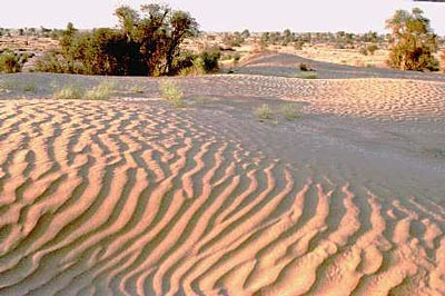
Lower Indus Plain:
The Lower Indus Plain, thus includes most of the Sind province. The soil is very productive and wherever water is available, the crops blossom. However, the Thar desert in its eastern portion is a classic example of how lack of water turns green fields into treeless desert. As the Indus approaches the Arabian Sea, it spreads out some 556,000 acres to form a delta, which is mostly marshy and swampy and includes mangrove forests. To the west of the delta is the seaport of Karachi; to the east the delta fans into the salt marshes of the Rann of Kutch.
The "Tharis" in Thar Desert
-
Upper Indus Plain:
The area north of Mithan Kot forms the Upper Indus Plain and is very fertile
because of the soil brought in by the Indus River. A number of canals criss-cross the area, adding to the fertility of the land and producing cash crops. Thal desert west of Jhelum, once arid and lifeless is now being turned into a settled area, mainly because of the Jinnah Barrage and canals
emanating from it. There are some small hills around Chiniot, Sargodha and Sangla which are being fast depleting for use in construction.
Deosai Plains:
Spread over an area of almost 3,000 square kilometers, the Deosai Plateau is
considered to be the highest plateau in the world. The plateau is located almost
at the boundary of the Karakoram and the western Himalayas. The undulating
meadows here have no trees or shrubs and the area is snow covered for most parts
of the year. The most enchanting feature of the Deosai Plateau is its huge field
of alpine flowers, the scale of which is largest in the Karakoram and the
Western Himalayas. Spring comes to Deosai late when millions of wild flowers
begin to bloom all over the lush green grassland.
Read More ....
Related Links
| Structural Trends and Focal Mechanism Studies in the
Potwar Area with
Special Emphasis on Hydrocarbon Exploration |
| Biking in
Balochistan desert |